


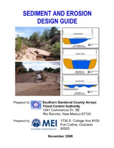
Sediment & Erosion Design Guide (SEDG) can be downloaded HERE
The purpose of this manual is to provide guidance for the analysis of sediment areas and arroyos in the SSCAFCA jurisdictional area, including methods for evaluating the potential effect of proposed structures or activities on the vertical and lateral stability of the arroyos and drainageways, and for establishing the Lateral Erosion Envelope (LEE) line. The LEE line is a boundary along an arroyo or drainageway that would have a low possibility of being disturbed by erosion, scour, or lateral migration of a natural (unlined) arroyo by storms up to and including the 100-year storm.
This Design Guide describes basic concepts related to the physical processes that control arroyo behavior, provides engineering tools that can be used to quantitatively analyze specific processes, and provides guidance on combining these tools to predict short- and long-term arroyo behavior.
[hr_small]At SSCAFCA, we encourage all property owners to implement erosion-control measures as needed to minimize the damage caused to your property by erosion. SSCAFCA has developed the Lateral Erosion Envelope (LEE) to help determine your property’s risk to lateral migration of our natural arroyo systems. Contact SSCAFCA to determine exactly where your property falls relative to the LEE.
LEE Informational Brochure can be downloaded HERE – Additional information on protecting your property can be found below.
When you incorporate these measures, you . By keeping rainfall on your property, you can prevent it from causing erosion to your soil or neighboring properties, as well as prevent sediment and pollutants from reaching the Rio Grande River. When properly controlled and utilized, rainfall can be used to irrigate landscaping, instead of using our aquifer’s supply of water. Every gallon harvested for landscape use is a gallon saved from the aquifer.
While there are companies and consultants who you can contact for erosion control, many homeowners can resolve problems using the techniques listed here.
Erosion Control Techniques for Property Owners
 Contours
Contours are imaginary lines that follow equal elevation points on your landscape. By creating a ditch or swale along the contour, water will spread laterally in the ditch and soak into the soil, instead of flowing downhill and eroding the slope.
Swales
Swales are the depression or ditch you can dig to move rainfall to a desired location. Because water collects here, swales are a great place to plant trees, shrubs or nonxeric plants.
Boomerangs
Boomerangs are small half-circle mounds of dirt on the downhill side of shrubs or trees. These allow water to be trapped where the plant can use it, instead of running downhill and gathering speed as it travels.
[hr_small] Surge basins
Surge basinscollect large amounts of water, such as rainfall from downspouts and the run-off from hard-scapes such as paved driveways or patios. Because surge basins are designed for high-capacity surges, they need to slow the water’s speed. For best results, locate the surge basin away from your home’s foundation. Line it with a geosynthetic fabric and secure it on the ground with landscape staples. This fabric will keep the water from undercutting the soil beneath decorative rock or another suitable material. Using rocks also slows the speed of the water. In areas of slow moving water, the fabric can be omitted and an organic mulch used instead.
[hr_small] Mulch
Mulch
Mulch can also be an effective erosion control material. Fibrous, woody mulches work best in our area’s heavy but infrequent downpours. Lighter weight mulches such as crushed nut shells or fi nely shredded bark or leaves often wash away. Mulches not only absorb water, but act as tiny dams to slow the speed of water. By keeping water in the soil, native plants can be established and their root systems will also stabilize the ground.
[hr_small] Sponges
Sponges are buried organic materials that will absorb water and retain it where it can benefi t plants. Following your contours, dig a trench that is 8 to 12 inches deep and 4 to 6 inches wide. Fill that trench with a fl ake from a straw bale, filling back in with the original soil. Sponges made from straw, compost, even newspaper or old telephone books will absorb many gallons of water, controlling runoff and providing an ideal planting environment for many years. Steeper slopes can be lined with entire bales, staked into place.
Overflows
Overflows are channels that would allow rising water in the surge basin to have an appropriate, controlled exit. Overflows should be placed to deliberately take this water to a place you want it in your landscaping, and should be lined with fabric and rock.